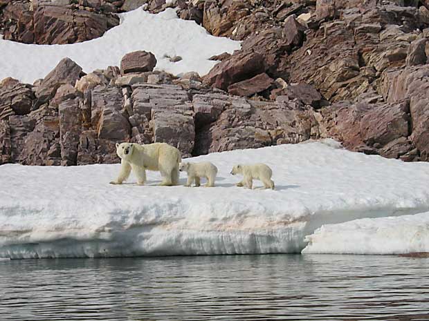
Scientists are using high resolution satellite imagery to count the number of polar bears.
Photo by Alastair Rae via Flickr.
By Natalie Hanniman
The tracking of polar bears is going out of this world.
Scientists at the University of Minnesota are using high resolution satellite imagery to track polar bears in northern Canada and Alaska.
The white bears stand out against the dark grey landscape in the images.
“All we’re doing is collecting two sets of satellite images and we compare image one to image two and we looked for white spots, essentially polar bears that would change between images,” said Seth Stapleton, a researcher at the University of Minnesota in Minneapolis.
This isn’t the first time satellite imagery has been used to look at the population of different animals. Scientists have previously used the technique to track penguins, seals and whales.
The new method will allow researchers and scientists to be less intrusive on their terrain, and collect population information more frequently than the current every 10-15 year plan.
“It’s a novel, non-intrusive way where we don’t have to dart the bear, or catch it and have a reliable estimate of the number of bears in an are,” said Peter Ewins, Arctic Species Specialist at the World Wildlife Fund Canada. “Through time we can track how the population is doing as the sea ice continues to change and retreat.”
The idea came about years ago — initially as a joke, Stapleton told Humber News.
“I was in discussion with my colleagues, we were jokingly saying ‘Wouldn’t it be funny if we used this idea of high resolution imagery to monitor polar bears?'” said Stapleton.
There happened to be another researcher at the university who had used the imagery to monitor animals in the Antarctic. “It was a serendipitous happening that we happened to be at the same place,” said Stapleton.
Stapleton first used the technique late in summer of 2012 on an island in Foxe Basin in Nunavut, an area that has a high density polar bear population during the ice free season. Polar bears are only visible in the images if there is little to no snow or ice on the ground.
After comparing both sets of images to confirm that what they thought was a polar bear was indeed a polar bear and not a rock or chunk of ice, researchers went out and conducted ground trothing to confirm their images.
“We obtained an abundance estimate for that island using areal survey,” said Stapleton. “So the satellite imagery estimate and the aerial survey estimate were very consistent which gives us a lot of promise for future applications.”
Satellite imagery helps scientists track how many polar bears there are and where they are going, but it doesn’t give any information on their health or wellbeing.
“We need much more information to make an assessment of status — body condition, movements and distribution, reproductive rates, age structure, survival rates, sea-ice conditions and harvest rates,” Andrew Derocher, a University of Alberta polar bear expert told the Toronto Star.
Stapleton has ideas to improve the technology, first he wants to get computerized detection to cut down the time it takes to compare photos.
“With improvements in technology and with improvements in how well we’re able to detect polar bears, I think eventually we’ll get to the point where we can see polar bears on ice but there is still quite a bit of work at this point.”

